Yosemite is one of the few U.S. national parks where visitors can enjoy most of the highlights from the comfort of a private vehicle. Whether you’re planning a full road trip or a short loop, driving through Yosemite National Park is one of the best ways to see its granite cliffs, waterfalls, and giant sequoias. Roads are clearly marked, and most major viewpoints and trailheads have parking areas so you can pause to take in the sights.
When driving through Yosemite National Park, you’ll want to prioritize the most scenic routes, including Tioga Pass and Glacier Point, and plan ahead for the best experience. In this guide, we’ll share our favorite drives and offer practical advice to help you make the most of your Yosemite adventure.
Best Scenic Drives in Yosemite National Park
- 1. Tioga Pass (Highway 120 Through Yosemite)
- 2. Hetch Hetchy Reservoir Drive
- 3. Glacier Point Road
- 4. Yosemite Valley
- 5. Mariposa Grove
Everything You Need To Know Before Driving Through Yosemite
- The Best Season To Drive Through Yosemite
- Entrance Fees, Park Passes, & Reservations
- Getting To the Park: Main Driving Routes
- Fuel, Food, and Rest Stops
- Driving Difficulty and Road Conditions
- Frequently Asked Questions
Best Scenic Drives in Yosemite National Park
The park’s stunning roadways wind through ancient forests, towering granite peaks, and lush meadows, offering lookouts and photo stops along the way. Whether you’re crossing the Sierra Nevada on Highway 120 through Yosemite, cruising up to Glacier Point, or exploring the Yosemite Valley Loop, each drive reveals a new side of the park’s natural beauty. Learn more about the best scenic drives in Yosemite National Park, including practical details and insider tips for making the most of your time on the road.
1. Tioga Pass (Highway 120 Through Yosemite)
The Big Oak Flat Entrance is just over 54 miles from the Tioga Pass Entrance along Highway 120, and the route is one of the best scenic drives in Yosemite National Park. Open roughly late May to early November, it climbs above 9,900 feet with sweeping views of granite domes, alpine lakes, and meadows. Driving straight through takes around 1 1/2 hours, but we recommend adding a few photo stops along the way.
- Top stops: Merced and Tuolumne Groves, Olmsted Point, Tenaya Lake, and Tuolumne Meadows
- Fuel: Chevron 8 miles before Big Oak Flat Entrance (west side)
- Access: Closed in winter; check NPS for road status before travel
- Tip: Start early, bring layers for high-altitude weather, and download offline maps.
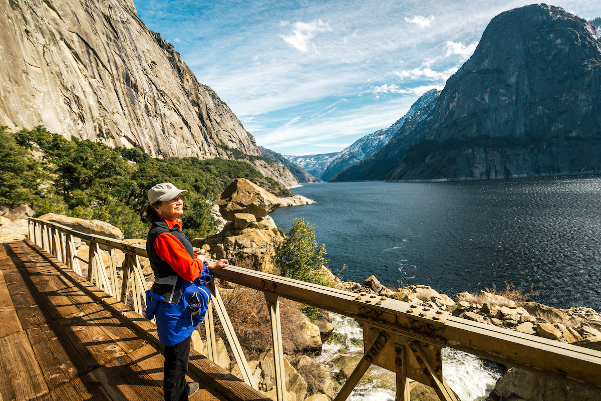
2. Hetch Hetchy Reservoir Drive
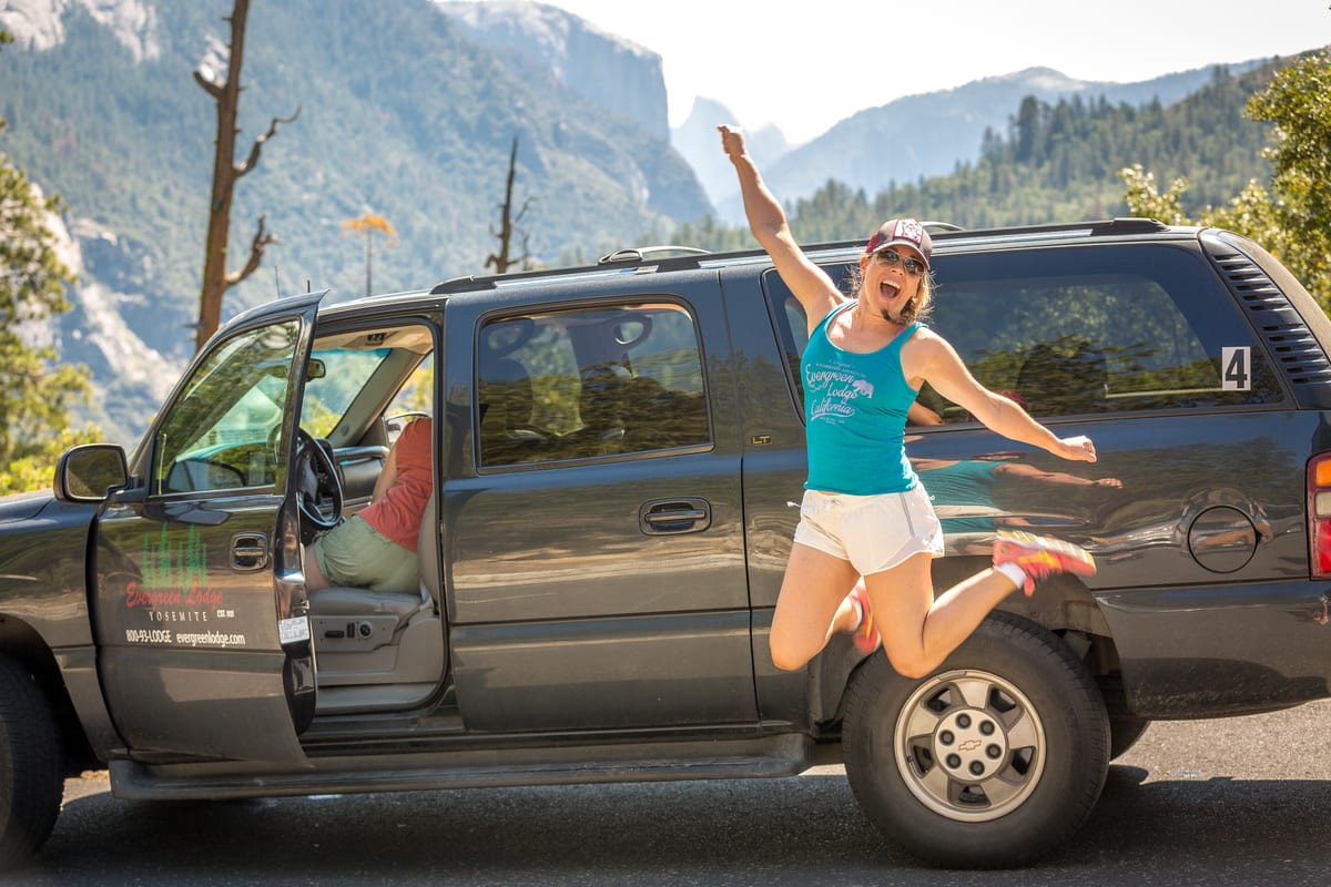
The Hetch Hetchy Drive is a short but rewarding route located near Yosemite’s northwest corner, just two miles from Evergreen Lodge. The road winds about 10 miles from the entrance gate to the Hetch Hetchy Reservoir, offering a quieter experience than Yosemite Valley and stunning views of granite cliffs and waterfalls. It’s a great option if you want to see Yosemite by car without heavy crowds.
- Top stops: O’Shaughnessy Dam, Wapama Falls Trail, and the Hetch Hetchy Reservoir overlook
- Drive time (without stops): Approximately 20 minutes each way
- Access: Open year-round; check for occasional winter closures
- Tip: Evergreen Lodge offers a variety of guided tours of the area.
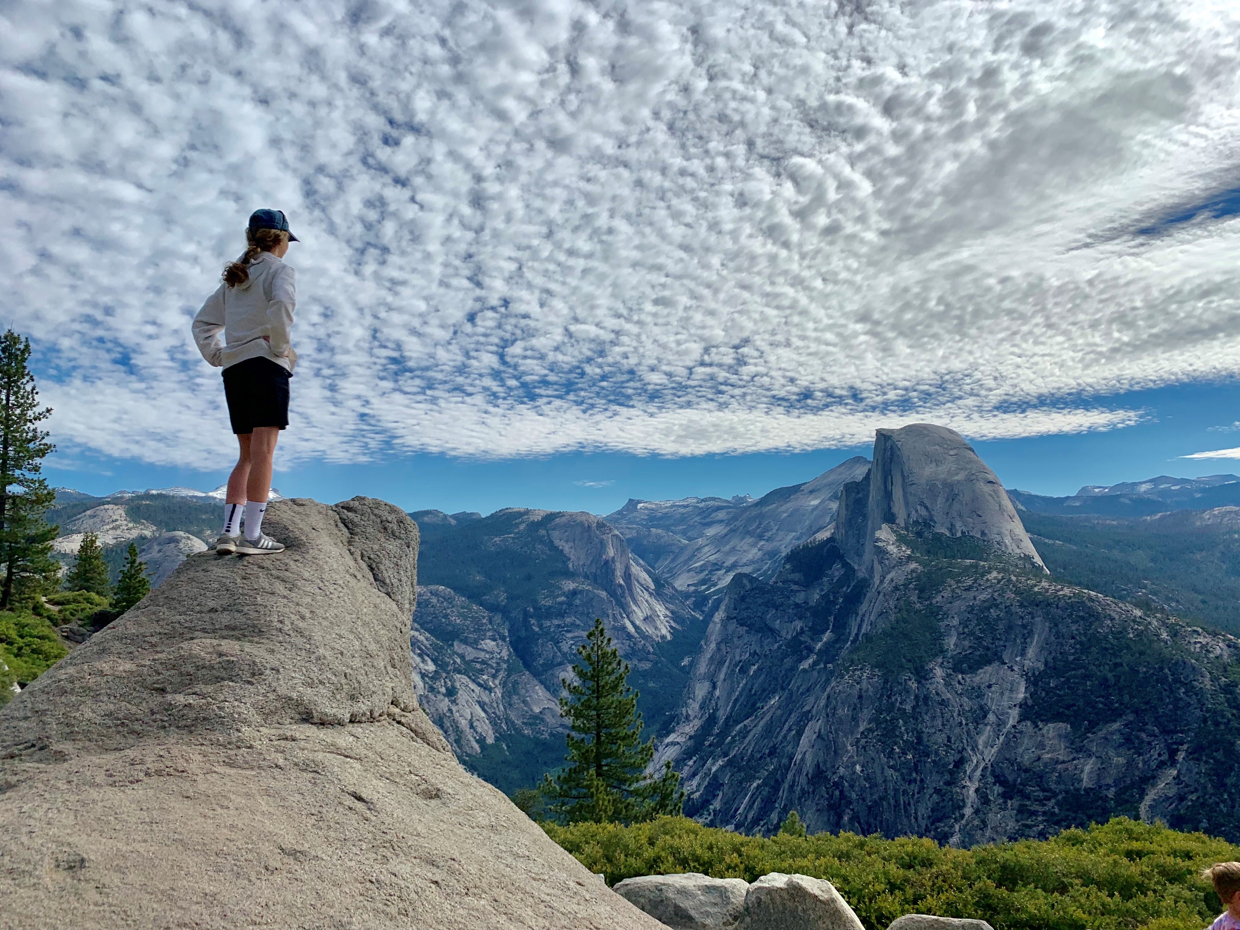
3. Glacier Point Road
Glacier Point Road begins about 17 miles from Yosemite’s South Entrance and roughly 16 miles from the Arch Rock Entrance, which is the closest access point for guests staying at our lodges and entering from Highway 120 West. The drive begins in thick forest before opening to dramatic valley views and continuing past Yosemite Ski & Snowboard Area (formerly Badger Pass) and the McGurk Meadow, Taft Point, and Sentinel Dome trailheads. Near the top, Washburn Point and Glacier Point Curve Vista offer breathtaking panoramas of Half Dome, Vernal Fall, and Nevada Fall — among the best views in Yosemite by car.
- Top stops: Washburn Point, Glacier Point Curve Vista
- Drive time (without stops): Approximately 30 minutes each way once you reach Glacier Point Road
- Access: Open late May–October; closed in winter due to snow
- Tip: Visit early or late in the day for fewer crowds and golden light.
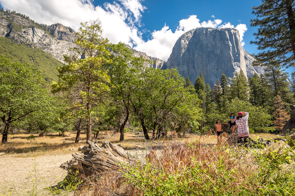
4. Yosemite Valley
The Yosemite Valley drive is the park’s most popular and accessible route, offering some of the most scenic views Yosemite has to offer. You can enter the Valley via Wawona Road (24.6 miles from South Entrance), El Portal Road (5 miles from the Arch Rock Entrance), or Big Oak Flat Road (17.5 miles from Big Oak Flat Entrance). The main 14-mile loop takes about 30 minutes without stops, but most visitors spend several hours exploring. Highlights include the iconic Tunnel View, Bridalveil Fall, El Capitan Meadow, Cathedral Beach, and Yosemite Falls. The valley’s Southside Drive is one-way in, and Northside Drive is one-way out, making navigation easy in both directions.
- Top stops: Tunnel View, Bridalveil Fall, El Capitan, Yosemite Falls
- Drive time (without stops): Approximately 30 minutes
- Access: Open year-round; some detours in winter
- Tip: Enter via Wawona Road for the famous Tunnel View reveal.
5. Mariposa Grove
Located near Yosemite’s South Entrance, the Mariposa Grove drive is the farthest from our lodges, but still worth doing if you have the time. It leads to the park’s most famous giant sequoia grove, home to the Grizzly Giant, California Tunnel Tree, and Faithful Couple. The route is about 10 minutes from the entrance to the Mariposa Grove Welcome Plaza, where visitors park and take a free shuttle (in season) to the grove. Only vehicles with disability placards may drive directly to the upper arrival area. The grove is a beautiful 4-mile round-trip drive or walk, surrounded by pines and oak forest, and offers several short trails among towering sequoias.
- Top stops: Grizzly Giant, California Tunnel Tree, Faithful Couple, Bachelor and Three Graces
- Drive time (without stops): Approximately 10 minutes from the South Entrance
- Access: Shuttle operates from spring through fall; road closed to most vehicles in winter
- Tip: Combine with Yosemite Valley for a full-day itinerary, wear sturdy shoes for short walks, and check NPS updates for shuttle and trail conditions.
Insider Tip: If you want to witness giant sequoias without making the drive, you’re in luck! Less than 20 minutes from Rush Creek Lodge are two lesser-known gems. Just inside the Big Oak Flat Entrance, you can find the Tuolumne and Merced Groves. Both groves are an approximate half-mile hike from the road. Here, you’ll find the first man-made Tunnel Tree in Yosemite National Park, carved in 1878. Stop by our Recreation Desks or give us a call for more free local expert planning advice and insider information!
Everything You Need To Know About Driving Through Yosemite
Planning your Yosemite road trip starts with timing and preparation. The park spans more than 1,100 square miles and ranges from low valleys to high alpine passes, so road access, weather, and driving conditions vary widely throughout the year. Whether you’re cruising Highway 120 through Yosemite, winding along Glacier Point Road, or exploring Yosemite Valley by car, knowing when to visit and what to expect will make your journey smoother and more enjoyable.
The Best Season To Drive Through Yosemite
The best time of year to drive through Yosemite is from May or June through early autumn. The weather is warm, the days are long, and the most beautiful routes, including Tioga Pass (Highway 120) and Glacier Point Road, are open.
During the cooler months, from November through April, several roads close due to ice and snow, particularly at higher elevations. If you’re planning a winter road trip through the park, Yosemite Valley and Highway 140 usually remain open year-round, offering a quieter way to experience the park by car. Viewpoints accessible by car in winter include:
- Tunnel View: Open year-round via Wawona Road (Highway 41). Tunnel View is one of the most famous spots in the park, featuring El Capitan, Half Dome, and Bridalveil Fall.
- Valley View: Located along Northside Drive, this easy pullout offers reflections of El Capitan in the Merced River.
- El Capitan Meadow: Accessible along Northside Drive; great for viewing climbers and sunset light on the granite wall.
- Sentinel Bridge: Drive or park nearby for a gorgeous view of Half Dome framed above the Merced River.
- Cook’s Meadow Loop: Open to vehicles nearby, Cook’s Meadow Loop offers great views of Yosemite Falls.
Always check current conditions and seasonal closures on the National Park Service website before your trip.
Entrance Fees, Park Passes, and Reservations
To drive through Yosemite, all vehicles must pay an entrance fee at the gate or have a valid national park pass.
- Private vehicle: $35 (valid 7 days)
- Motorcycle: $20 (valid 7 days)
- Individuals (on foot, bike, or horseback): $15 per person
- Yosemite Annual Pass: $70 for 12 months of unlimited entry to Yosemite
- Annual “America the Beautiful” Pass: $80, providing unlimited access to all U.S. National Parks
If you’re only driving through Yosemite on Highway 120 from one side of the park to the other without stopping, you can request a time-stamped transit pass at the entrance. This allows through-travel without paying the full park fee as long as you do not stop inside the park.
Reservations: At time of writing, reservations are not required to drive through Yosemite, though temporary reservation systems may be reinstated during peak summer periods. Always check the NPS Yosemite Reservations page before your trip for current policies and pricing details.
Getting to the Park: Main Driving Routes
Yosemite is accessible by several highways that connect the park’s major entrances and landmarks:
- Highway 120 (Tioga Pass Road): Crosses the park east to west and is the most scenic route, linking the Big Oak Flat Entrance to the Tioga Pass Entrance near Lee Vining.
- Highway 41 (Wawona Road): Leads from the South Entrance toward Yosemite Valley and Glacier Point Road
- Highway 140 (El Portal Road): A lower-elevation route offering year-round access to the Valley, even in winter
Depending on the route and traffic, it takes about 1 1/2 to 2 hours to drive straight through Yosemite, though most visitors stop frequently at lookouts and trailheads along the way. It’s easy to make a full day out of a drive through the park by almost any route, so plan accordingly.
Fuel, Food, and Rest Stops
Gas stations inside Yosemite are limited, so it’s smart to fuel up before entering. There are two spots to stop if you need to top off the tank in the park:
- On the west side: A Chevron station is located about 8 miles before the Big Oak Flat Entrance.
- On the east side: Near Lee Vining, the Mobile station at the end of Highway 120 is famous for its picturesque views and surprisingly good food.
Inside the park, you can access services in Yosemite Valley, Wawona, and Tuolumne Meadows during the summer. Most visitor centers and lodges also offer restrooms, snacks, and picnic areas.
Driving Difficulty and Road Conditions
While nearly all the roads in Yosemite National Park are well-paved and safe for most vehicles, expect steep grades, sharp curves, and slow speed limits in mountain sections.
Quick Tips for a Smooth Drive
- Use lower gears on downhill stretches to reduce brake wear.
- Be prepared for changing weather, especially at higher elevations.
- Know that tire chains may be required in winter, even for four-wheel-drive vehicles.
- Start early to beat crowds and secure parking at popular viewpoints.
- Download maps before entering the park — cell service is limited.
- Bring water, snacks, and layers for changing temperatures.
- Plan fuel stops in advance, especially if crossing the park via Tioga Pass.
Driving through Yosemite National Park is manageable for most visitors — and one of the most unforgettable ways to experience its beauty. Take your time, watch for wildlife, and enjoy the incredible sights! From towering granite cliffs to peaceful alpine meadows, every mile offers new sights to expand your perspective.
After a day on the road, unwind in comfort at one of our Yosemite Hotels, the perfect base for rest, relaxation, and planning your next adventure.
Frequently Asked Questions About Driving Through Yosemite
Can you drive the 120 through Yosemite?
Yes. According to the National Park Service website, drivers are permitted to drive through the park without paying a fee. A time-stamped pass is provided that allows for enough time to make it from one end of the park to the other along the fastest route. Stopping for photos along the way is not permitted.
Do you need a reservation to drive through Yosemite?
Reservations are not currently required to drive through Yosemite National Park. However, we recommend checking the Yosemite National Park FAQs before your visit in case this changes.
Can you drive through Yosemite in a day?
Yes, you can drive through Yosemite National Park in a day and see all the great sights from your car, but merely driving through the park introduces you to only a small portion of its beauty. Check out our recommendation of how many days you should spend in Yosemite.
What is the main entrance into Yosemite?
The Big Oak Flat Entrance on Highway 120 is considered the main entrance into the park. This entrance is only 1 mile from Rush Creek Lodge & Spa.
How far is it from San Francisco to Yosemite National Park?
From downtown San Francisco to the Big Oak Flat Entrance of Yosemite National Park is 167 miles. It will take approximately 3 hours and 20 minutes to drive.
What is the closest town to Yosemite?
The closest town to Yosemite depends on which entrance you take:
- From the South Entrance: Fish Camp (2.4 miles via Highway 41 South)
- From the Arch Rock Entrance: El Portal (8.6 miles via El Portal Road)
- From the Tioga Pass Entrance: Lee Vining (12.7 miles via Highway 120 East)
- From the Big Oak Flat Entrance: Groveland (24.1 miles via Highway 120 West)
- From the Hetch Hetchy Entrance: Groveland (28.1 miles via Highway 120 West)
How much does it cost to get into Yosemite?
According to the National Park Service, the entrance fee for non-commercial vehicles, RVs, and large vans (with 15 or fewer passengers) is $35 per vehicle. The entrance fee for motorcycles is $20 per motorcycle, and the fee for bicyclists, horseback riders, and walkers is $15 per person.
How long does it take to drive through Yosemite?
Depending on traffic, driving through Yosemite National Park typically takes about 30 minutes. However, you can easily make a full day of your drive through Yosemite thanks to the many sights and hiking opportunities along the way.
Is the drive to Yosemite steep?
The drive to Yosemite via Highway 120 is steep. This road ascends to more than 2,500 feet in just the 8-mile section between Tioga Pass and US 395.